

Stepping back in time, Kosher style
I got bored and found myself digging into some old databases. I discovered something amazing.
While my father rested, I got a bit fidgety. I’d only been visiting my parents for a few hours, but the house was quiet, and I’d spent most of the day in a car. I needed something to do. It happens that behind me, on the wall next to the dining room table, I saw a sign.
“Strictly Kosher,” it read. A bit of irony, considering I’ve eaten shrimp salad sitting at this very table. “Tanowitz Finest”. It’s the framed replica of the sign that hung in my Grandfather’s butcher shop in Brooklyn, but in my memory, it hung in their basement in Rockland County, NY. My aunt has the original, my brother had a high-quality scan done, and created this for my parents’ wall.
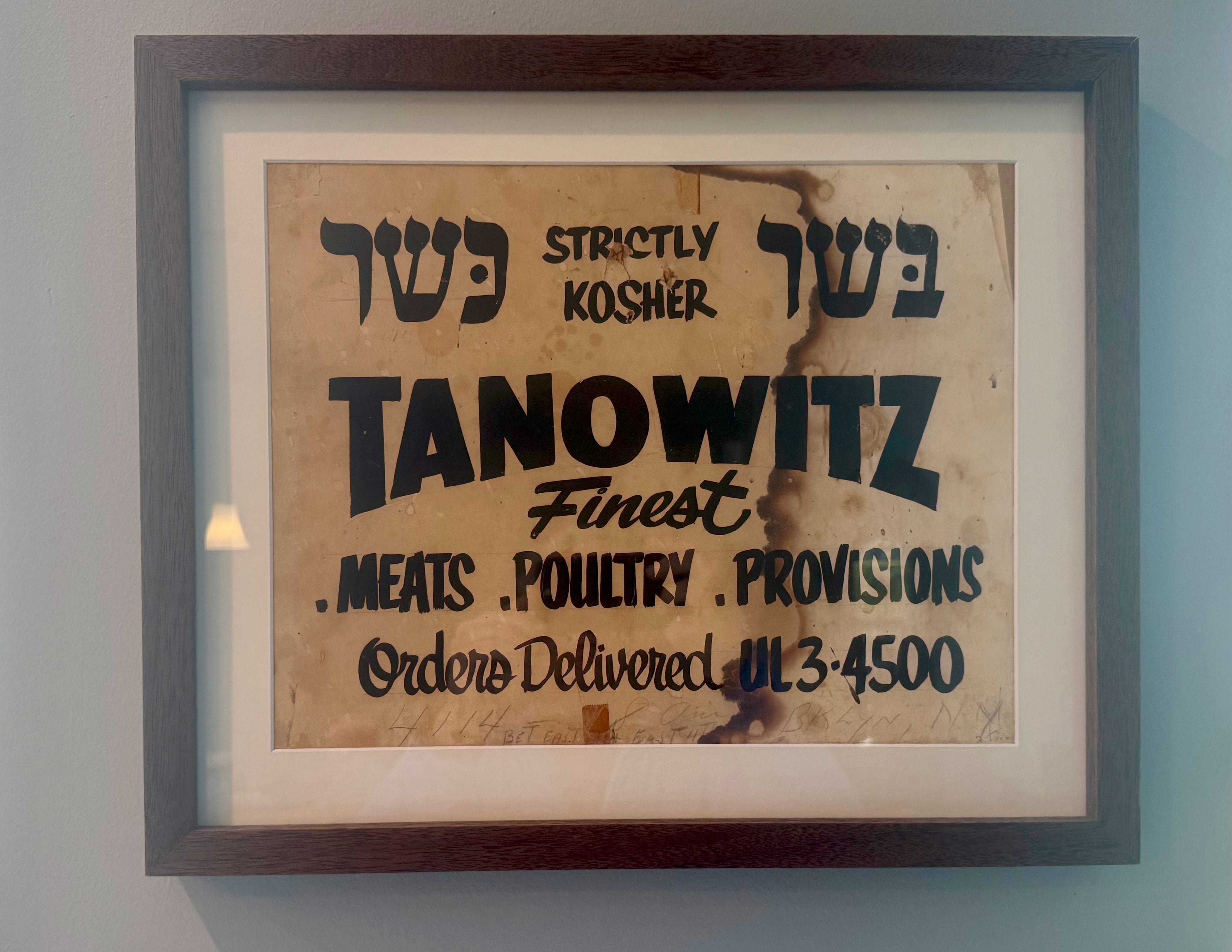
Handwritten, in a way that’s hard to read, is an address. And that’s what intrigued me. So with my laptop in place, a connection to the internet, and 30 minutes of idle time, I set to work.
I started by entering what I thought was the address into Google Maps to see where things would be, and even tried asking my resting dad. He started throwing out random locations that didn’t seem to make sense. Then I remembered the New York City street photo database from the 1940s.
In 1938, the New York City Tax Department received funding from the Federal Works Projects Administration (WPA) to take on an ambitious project: photograph every taxable property in New York City. Think of it as Google Street View, but with a ton more effort. The original goal was to create a baseline that could be updated every year, but that idea fell apart thanks to the outbreak of World War II broke out, just as the initial project neared its end.
While Google sends out a car with a mounted camera that just drives around and captures tons of images, this project lasted from 1939 to 1941 and included nearly 1000 people: 900 administrative workers and 32 photographers, resulting in 722,485 images on 19.85 cubic feet of film. Thankfully, New York City has been pretty diligent about ensuring that the images remain preserved, giving us a wonderful view into pre-war New York City.
After a bit of Googling, I found an online New York City directory from 1940, and after a few minutes of digging, I located two butcher shops. One operated by my great-grandfather, Sam, the other by his brother Joseph.
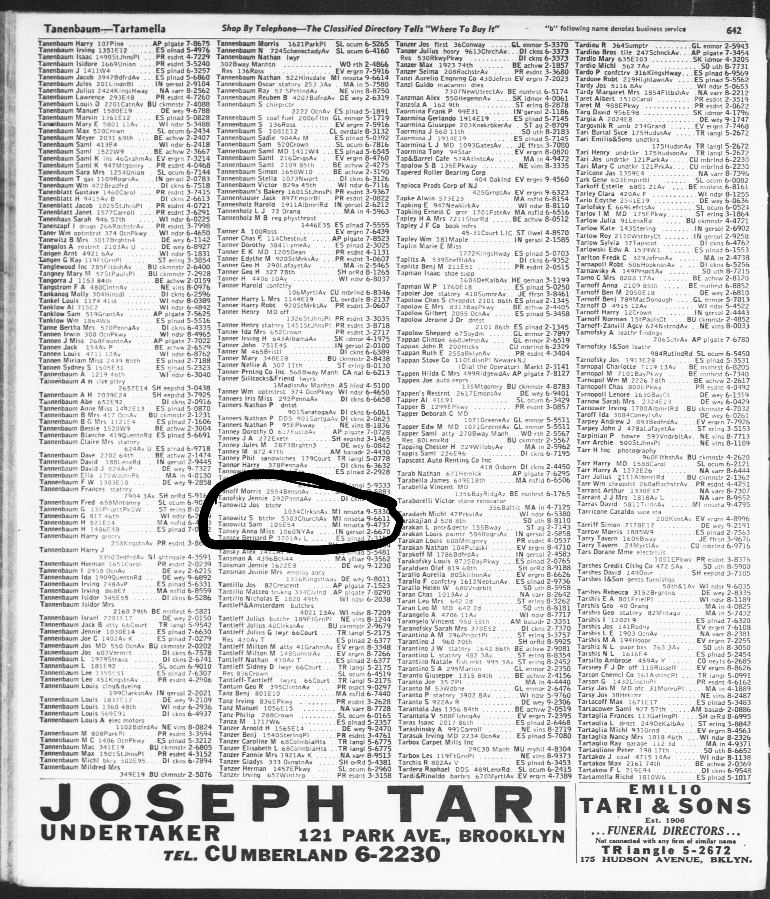
I took those addresses and went into the photographic database and entered the world my father would be born into a few years later: a deeply Jewish section of Brooklyn that has morphed and changed since then. The areas that had been home to Kosher delis, butchers, and fishmongers are now home to entirely new populations. There is still a Jewish Brooklyn, but it’s much different than the one my father grew up in.
The location of my great-grandfather’s brother’s shop was hard to see, since the building was photographed from a distance. But when I looked at 5303 Church Ave. in Brooklyn, my great-grandfather’s shop wasn’t only there, but we found another surprise: my great-grandfather standing in the doorway. I showed it to my dad, and he confirmed it. Yes, that is, in fact, my great-grandfather.
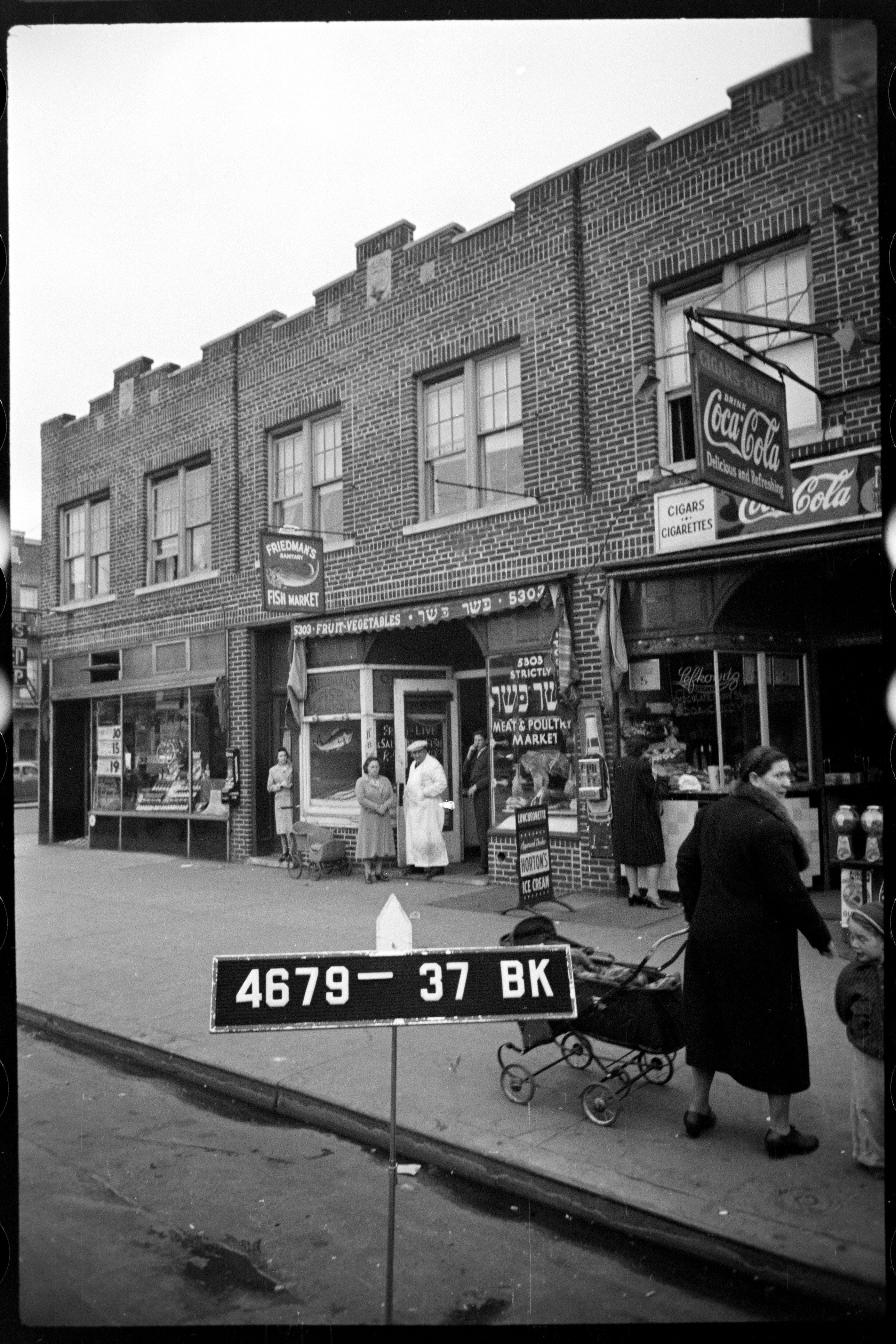
So on a random afternoon, armed with just a laptop and some time, I looked back more than 85 years and found my great-grandfather doing his daily thing.
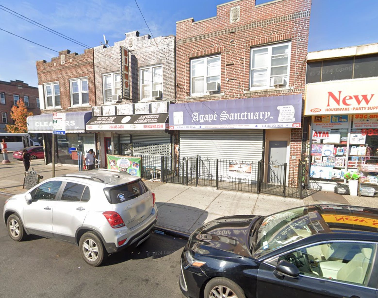
It turns out that the building is still there, though it’s now a martial arts academy for local kids. Even the curb and sidewalk remain exactly as they were. If I have time, maybe I’ll stop by and get a shot of me in the same location.
Fun detective work. So did the storefront have two entrances? one for the fish market with fruit and vegetables, and one for the butcher? Or everything (except dairy) sold in one place?